How to Add Basemaps in QGIS
QGIS only has one basemap that is included by default, Open Street Map. However, QGIS does have the functionality to support many different types of basemap sources and services. Basemaps can be added to QGIS by copying the URL to a web map service and pasting the URL to the proper data source in QGIS. This is a very simple process, but it may be difficult to know exactly what to do if you are new to QGIS. This tutorial will demonstrate three ways to add basemaps to your QGIS project.
- Default OpenStreetMap
- Web Map Service (WMS)
- XYZ Tiles
If you are new to QGIS, or are unfamiliar with the terminology used in this article, check out my free QGIS tutorial for a quick, yet comprehensive introduction.
Add the Open Street Map Basemap to QGIS
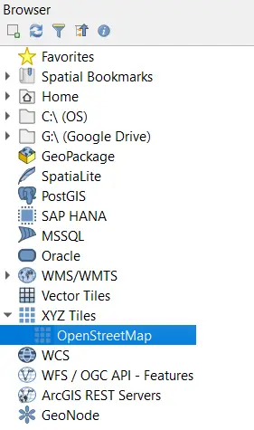
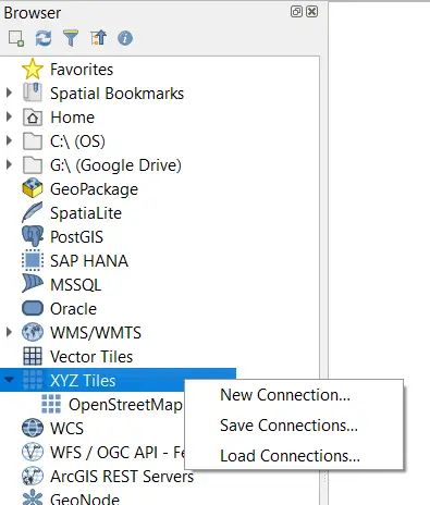
Open Street Map is the only basemap included, by default, with QGIS. If you don’t know where it is, it can be a little bit difficult to find. Open Street Map is located in the Browser Panel under XYZ Tiles.
When you expand XYZ Tiles, you will see the OpenStreetMap listing. Click it and drag it onto the map canvas to add it to your project as a layer.
To add OpenStreetMap to a QGIS project:
- Navigate to XYZ Tiles in the Browser panel and click the arrow to expand
- Drag OpenStreetMap into the map canvas
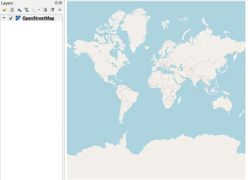
OpenStreetMap has worldwide coverage of cities, roads, political boundaries, and other places of interest.
Add Web Map Services Basemaps to QGIS
Web Map Services (WMS) are probably the most common source for QGIS basemaps. There are thousands of WMS maps available for public use. I commonly use WMS for basemaps in QGIS. Depending on your area of interest, you should be able to find satellite imagery, elevation, and terrain WMS to use for basemaps.
To add a WMS to QGIS follow these simple steps.
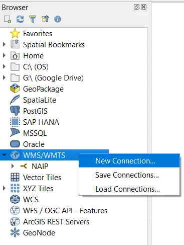
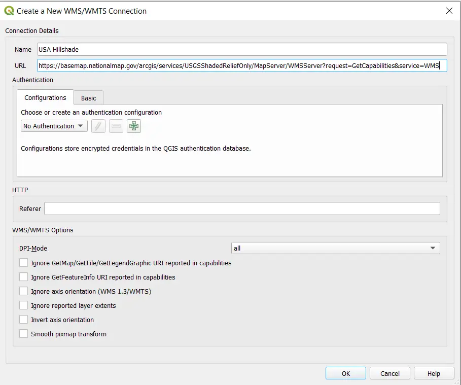
- Navigate to WMS/WMTS in the Browser panel
- Right click on WMS/WMTS and select New Connection
- Enter the URL and a Name fo the connection
- Click OK
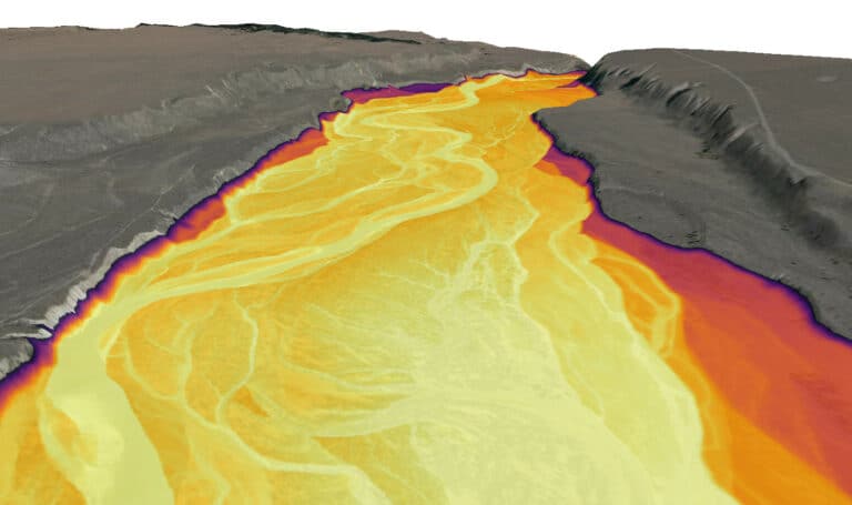
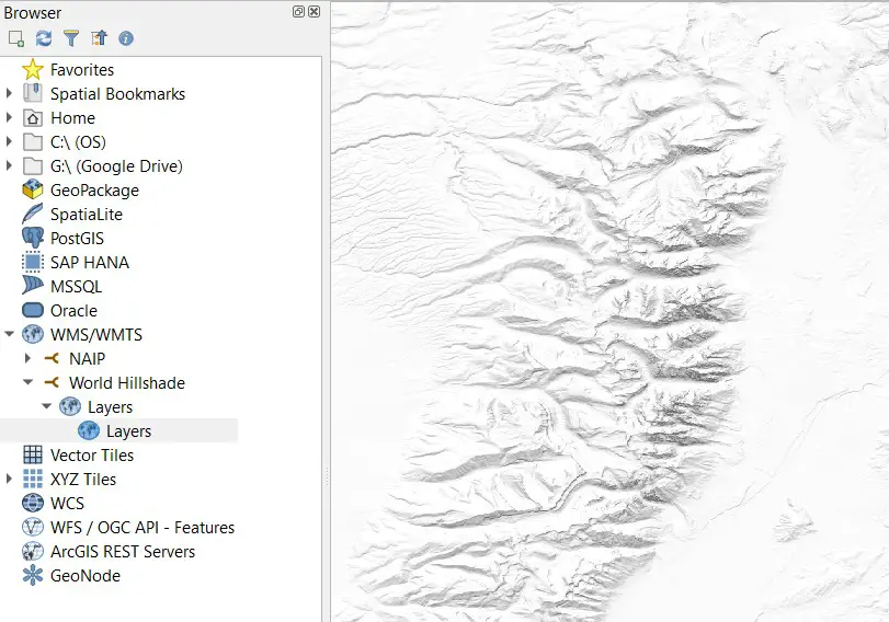
Now you can drag the newly added WMS (or WMTS) layer into the map canvas to add the basemap. The image below shows a (portion of a) publicly available shaded relief map for the entire world.
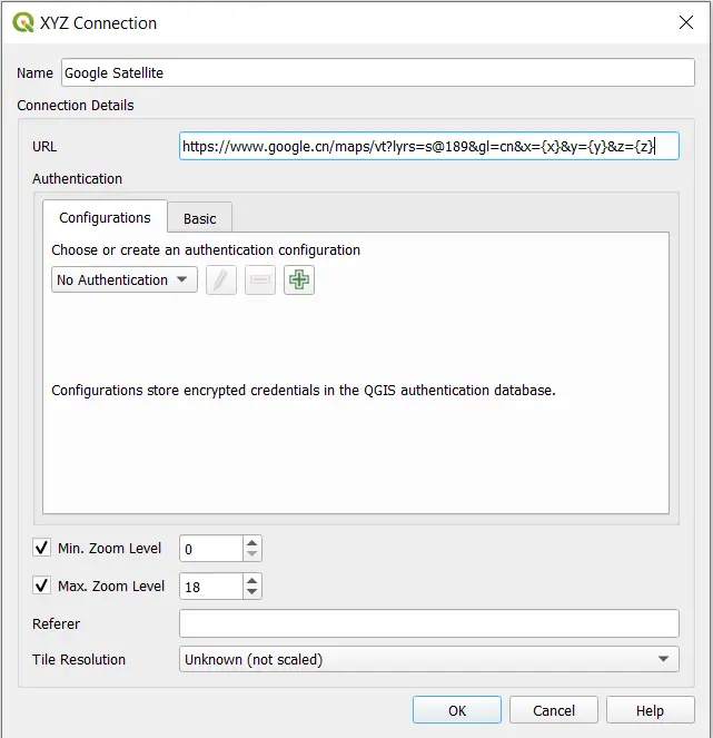
Add XYZ Tiles Basemaps to QGIS
Basemaps that are stored as XYZ tiles can be easily added to QGIS. Many popular basemaps, including Google Satellite imagery, roadmaps, and terrain maps can be accessed as XYZ tiles. This article will give you a step-by-step guide for adding Google basemaps to QGIS.
To add a XYZ Tiles basemap to QGIS:
- Navigate to XYZ Tiles in the Browser panel
- Right click on XYZ Tiles and select New Connection
- Enter the map URL a name for the connect
- Click OK
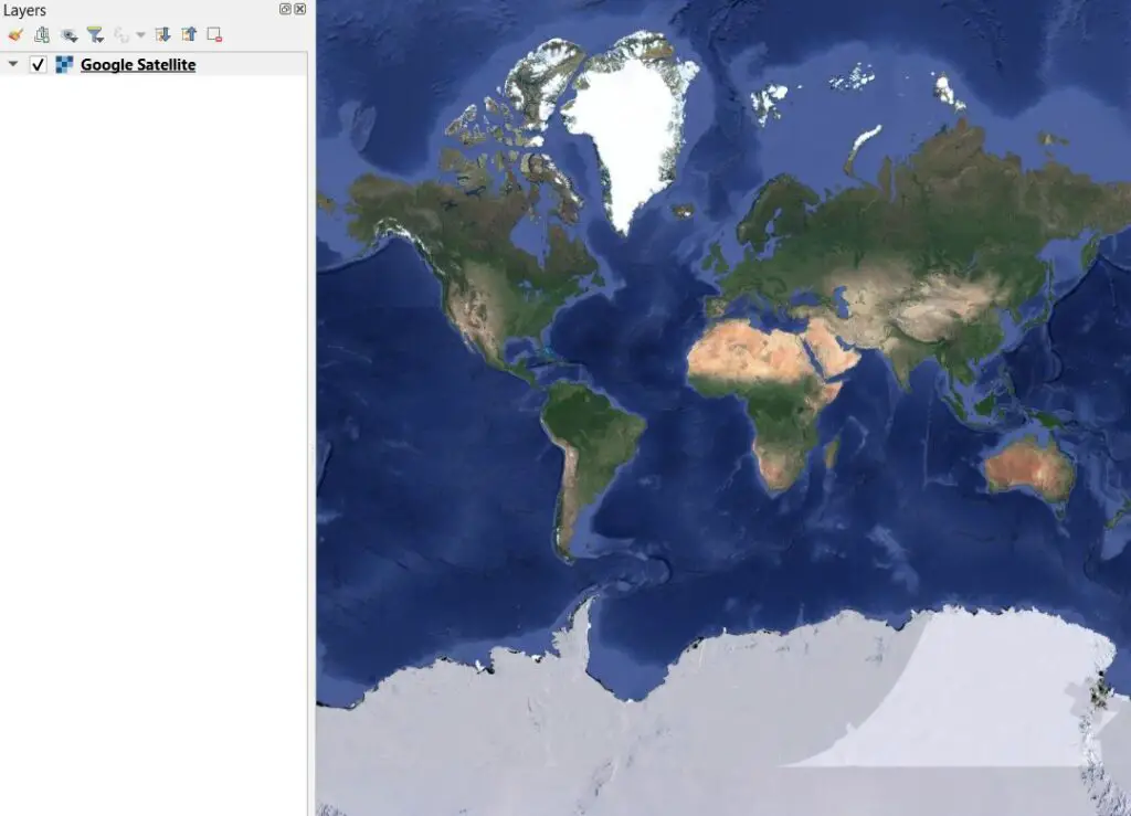
You will now see a new entry in the Browser panel under XYZ Tiles. Click and drag this entry onto the map canvas to add the basemap to the project as a layer.
Thousands of Basemaps Are Available for Free
There are thousands of web-hosted basemaps available for use in QGIS. The trick can be finding the specific map that you’re looking for. Governments around the world are now hosting maps as WMS layers that are publicly available, so it’s worth checking government data websites for their map services. An internet search for the type of map you want plus ‘Web Map Service’ will often get good results. If you’re looking for a starting point, check out this article where I explain how to get a free satellite imagery basemap.
Whether you’re looking to take your GIS skills to the next level, or just getting started with GIS, we have a course for you! We’re constantly creating and curating more courses to help you improve your geospatial skills.

All of our courses are taught by industry professionals and include step-by-step video instruction so you don’t get lost in YouTube videos and blog posts, downloadable data so you can reproduce everything the instructor does, and code you can copy so you can avoid repetitive typing