How to Download Landsat and Sentinel Images for Free
Satellite images are important data sources for many remote sensing and GIS analyses. Today many different satellites circle the globe and collect various image types. Images from many of these satellite platforms are available free of charge. This tutorial will demonstrate how to download images from the Landsat (Landsat 9) and Sentinel (Sentinel 2) satellites using USGS EarthExplorer.
Create an Earth Explorer Account
You will need a free EarthExplorer account to download data from the website. EarthExplorer accounts are free, so creating an account won’t cost you anything.
To create an EarthExplorer account:
- Navigate to earthexplorer.usgs.gov
- Click ‘Login’ in the upper-right corner of the page
- Click the button to ‘Create New Account’
- Enter the requested information
- Verify your email address
Once your account is verified, be sure you are signed into EarthExplorer. Your email will appear in the upper-right corner, next to the logout button, if you are logged in.
Enter Image Search Criteria
The first step to download Landsat and Sentinel images is to set some search criteria. Here you will choose a location, date range, and cloud cover percentage to determine which images will be returned.
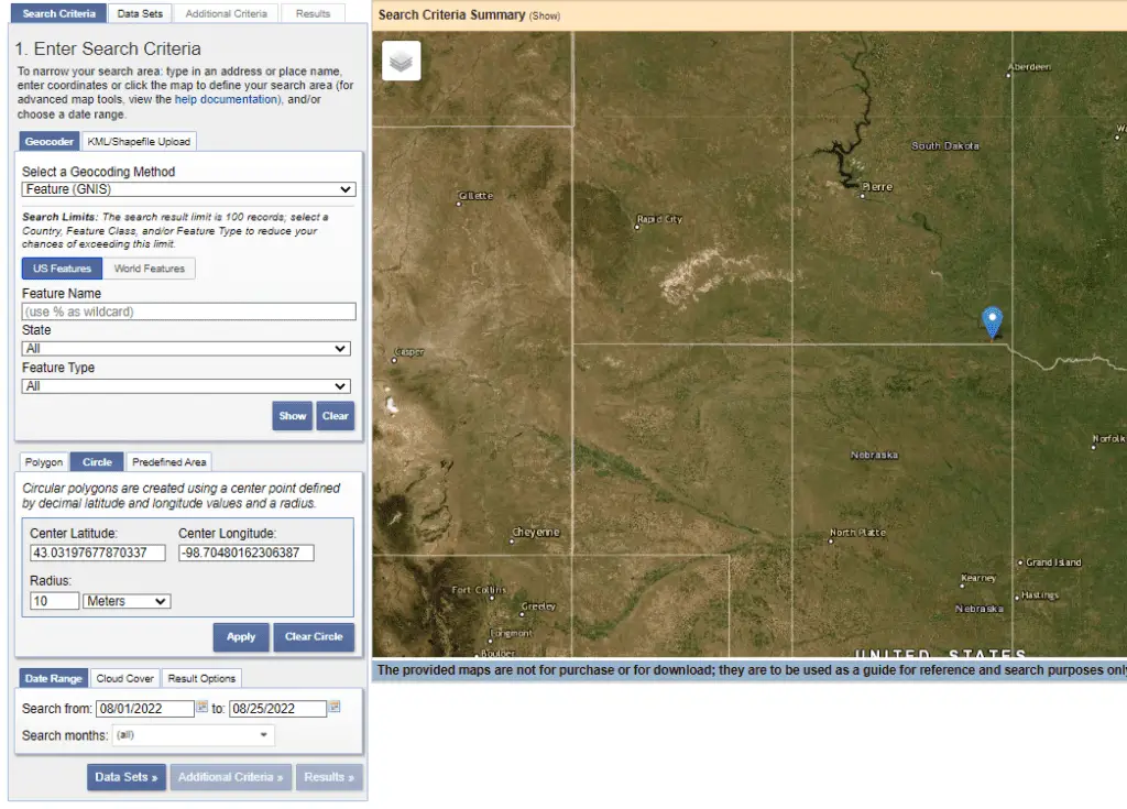
In the image below you will see I’ve used the ‘Circle’ method to identify the image location. To do this, I clicked the ‘Circle’ tab, then clicked on the map to autofill the latitude and longitude coordinates. I specified a small radius because I’m interested in retuning images only for the exact location.
You can use the circle method, draw a polygon, or upload a shape to define your area of interest.
I’ve also set a date range for the images from August 1, 2022, to August 25, 2022. On the Cloud Cover tab (next to the Date tab) I set the maximum cloud cover to 20%.
Now we are ready to continue forward and select the Data Sets we wish to search for. To do this click the Data Sets button at the boom of the Search Criteria section, or click the Data Sets tab at the top of the page (next to the Search Criteria tab).
Identify and Select Data Sets
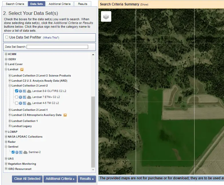
The Data Sets tab is where we will select the specific datasets (i.e. satellites) we wish to search for. You’ll notice there are many other data types that we can download with EarthExplorer. For this tutorial we’ll focus on downloading Landsat 9 and Sentinel 2 images.
Expand the lists for the Landsat and Sentinel options. The only Sentinel option is Sentinel-2. Click the box next to Sentinel-2 so that a checkmark appears. Now, Sentinel-2 images will be added to the search results.
Landsat has many download options. For this example, we’ll download Landsat 9 data from the Collection 2 Level-2 group. Our search results will include both Landsat 8 and Landsat 9 images. Notice that you can also download analysis-ready data for Landsat images.
The image below shows the data sets I selected to include in the search results.
Once you have made your data set selections continue to the Results tab. If you like you can add Additional Criteria to your image search. I usually don’t do this, so we won’t cover additional criteria in this tutorial.
Downloading Landsat 9 and Sentinel-2 Images
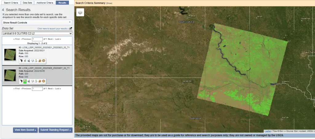
When you click on the Results tab it will take a minute or two to find the results based on your search queries. The available images will then appear in a list on the left side of the screen. You can show a thumbnail overlay of each image on the map by clicking the ‘Show Browse Overlay’ button associated with each image (highlighted in green in the photo below). To remove the overlay, click on the Show Browse Overlay Button again.
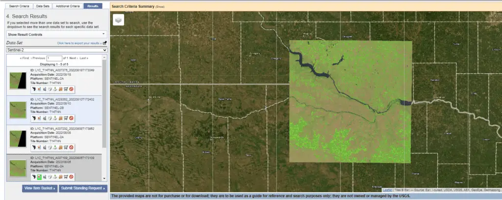
In my results list (shown below) you’ll notice that only Landsat images appear. Toward the top of the Results and is a drop-down to select which data set results are displayed. I can change this to Sentinel-2 to get a list of the available Sentinel-2 images.
As with the Landsat 9 images, you can click the Show Browse Overlay for a thumbnail for each Sentinel image to appear on the map.
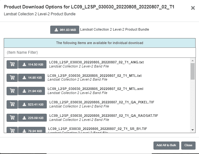
Once you’ve identified the images you wish to download, simply click the Download button associated with the image. This will bring up the Product Download Options. Download options are different for Landsat 9 and Sentinel-2 images.
With Landsat 9 images you will have the option to download all the data for an image, or to download data for specific bands (see image below). For Sentinel-2 images, you have the option to download all the data in JPEG2000 format (which is probably what you want), or to download the browse overlay image as GeoTIFF (this image does not contain all the data).
Now all you need to do is decide which images to download then start analyzing and visualizing!
Conclusion
Satellite imagery is a great resource for many applications. Best of all, many satellite images are available to you for free! Get a free EarthExplorer account and download some satellite images so you can find out what the earth around you looks like!