Up next in 10

This GIS tutorial tests Mundi. Mundi is a FREE, Open-Source agentic AI platform built for working with geospatial data. We'll test how well it works for performing basic tasks on a simple DEM.
Check out my website for more: https://opensourceoptions.com
Show More Show Less View Video Transcript
0:01
Hey folks, welcome to Open Source
0:02
Options. Today we're testing out
0:05
something that you usually don't see.
0:09
It's an opensource
0:11
goi
0:13
webgis called Mundi. Uh it's developed
0:17
by the folks over at Bunting Labs and uh
0:22
I've played around with a little bit but
0:23
not a lot. And today we're going to go
0:25
through it together and just see how
0:27
well a Gentic AI works in an open source
0:31
platform for performing GIS analysis.
0:34
Before you start, you'll need to create
0:36
an account, which is really easy to do.
0:39
I've done that already, so it's going to
0:40
take me right to the maps page. Um, so
0:43
let's go ahead and get started. I'm at
0:46
mundi.ai. I'm going to go ahead and just
0:48
click try for free.
0:51
And I'm going to click create my first
0:52
map.
0:54
And let's go ahead and just open this
0:56
map up. And you'll notice we have a
0:59
globe here. And from here we can do a
1:00
lot of different things. We have some
1:03
options to add a layer source or to load
1:06
PostGIS. Over here we can add API keys,
1:10
log out with documentation, um, schedule
1:13
a call for other information.
1:16
I'm going to start out by adding a
1:18
raster layer. So I'm going to add a
1:20
layer source. I'm just going to upload a
1:22
file
1:26
and I'm going to go into I have some
1:29
stuff in my downloads folder.
1:32
Um
1:34
probably going to be way down here.
1:40
Let's search for it. I have some 3D data
1:49
in this folder
1:52
and we'll add in Eclipse DEM. It's not
1:55
too large so it doesn't take too long to
1:57
upload. You can see it is being a little
2:00
bit slow here. I have a pretty fast
2:02
internet connection. Um so I'm not 100%
2:05
sure it's their server, but that would
2:08
be my guess. So, let's come down
2:13
and
2:15
we're going to go to the 10 meter folder
2:18
and then we're going to come down and
2:20
add in this clipped
2:23
uh raster. Okay, so we've got that
2:26
added.
2:28
Now, we can click here and zoom to that
2:30
layer.
2:34
Okay, there we go. We have this DEM. Uh,
2:37
let's just double check and make sure it
2:38
shows up where it's supposed to. We're
2:41
in northern Utah. That's where it should
2:43
be. Now, here's one thing to notice that
2:45
doesn't appear until we get zoomed in
2:48
relatively close.
2:50
Now, we have this uh AI agent Q that we
2:54
can ask to do certain tasks. So, let's
2:59
just try to change the symbology
3:03
of the raster to grayscale. Let's just
3:05
give that a try first
3:08
and see if we can do this. You can see
3:11
that it's thinking. We'll see just how
3:14
long it takes to think.
3:22
Okay, it says updated this
3:28
um
3:30
but nothing updated.
3:39
So, we'll just say the display did not
3:40
update.
3:51
So, we can try refreshing the map view.
3:53
So, let's try this.
3:56
Yeah. So, it still didn't work. Um,
4:01
okay. That's fine. Not a big deal. Let's
4:03
try something else. Um,
4:07
create a histogram
4:10
of
4:11
elevation values
4:14
from the raster.
4:16
Let's see if we can do this pretty
4:17
easily.
4:22
Still thinking
4:28
now we're running the analysis.
4:34
and still thinking.
4:37
So,
4:39
it's kind of slow to do some of these
4:41
things. It could and I guess I should
4:43
add some things here. I mean, we're
4:45
running this on the free server,
4:47
obviously, so the resources may not be
4:49
the most robust, which makes sense with
4:50
the free product. Um, this is open
4:53
source and fully extendable, so you can
4:55
take this and make API calls and run it
4:58
on uh your own server. So you can
5:01
customize this for what you would like.
5:03
Okay, look at this. Here we go. Now we
5:07
have
5:10
um the histogram of those values.
5:14
Uh it's small and it's hard to see and
5:16
there's not a great way to make it
5:19
bigger, but it did produce that
5:22
histogram pretty quickly. Okay, let's
5:24
try something new. Um
5:29
let's let's try let's get some summary
5:32
statistics.
5:33
Um please compute summary stats deliver.
5:41
Okay, now we're going off thinking and I
5:44
guess the the thing that's hitting me so
5:46
far with this is with the time it takes
5:49
Q to evaluate the query and go off and
5:52
perform the analysis. If I was in QGIS,
5:56
I could have already had that
5:58
information.
6:00
Um, the statistics came through pretty
6:02
quick, so that's good.
6:05
Okay,
6:08
cool. Now, um,
6:11
let's try to do some actual calculations
6:14
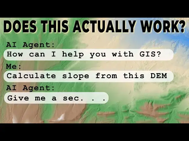
on the raster. So, let's try calculate
6:19
slope in degrees
6:21
for the DEM. Let's just calculate in
6:24
bold. Let's just well we'll just do
6:25
degrees for the
6:29
Okay, let's give that a try.
6:34
And the cool thing, you can see your
6:35
chats are saved over here. Um,
6:40
and so if we come back and save this map
6:42
and come back later, our chats will
6:43
still be there. We can go back and see
6:45
what we asked and and what was done. And
6:50
keep in mind this is just on a raster
6:53
layer right now. We will make another
6:56
video testing this out with uh some
6:59
vector data and we may get better
7:01
performance there. We may also want to
7:02
try this with vector and raster data and
7:05
see how that works out.
7:09
Okay, so it says it's computed the slope
7:12
in degrees and saved it as slope
7:16
degrees.tiff.
7:17
It's available for download here. Um,
7:22
uh, yes, please add it to the map. It
7:24
does. We want to add it to the map. Um,
7:29
so yes,
7:33
so let's see if this will work.
7:40
So again, thinking
7:49
So it says that um we have to add it to
7:52
the project ourself.
7:58
Okay. Um so what
8:01
is
8:03
the file path I need to add to the
8:05
project?
8:08
I have to ask what file to add. We have
8:09
this one.
8:13
Maybe it's here.
8:16
Okay.
8:18
Also, we have to download it and then
8:21
add it. So, that's kind of a pain. Um,
8:24
that would just be way easier to
8:25
calculate in QGIS if we don't have to go
8:27
through the downloading and adding to be
8:28
able to do anything with it. Let's just
8:31
see. Can you show me
8:38
Can you show me an image of the slope
8:39
raster?
8:42
Let's just see if it'll show an image of
8:44
that. I'm not going to go download it
8:46
and add it. That seems like a lot of
8:47
work.
8:55
So, I think we've run into the first big
8:57
issue with this platform right now, and
9:00
that's that we can't actually take that
9:02
result and add it back into our map. Um,
9:06
now, if you're running your this on your
9:08
own server with your own resources, that
9:11
might be easier. So instead of having
9:13
this in your sandbox results, you know,
9:15
a temporary file location, uh this might
9:18
be something you can save to your server
9:20
in a designated location and then make
9:24
it easier to add into your project. Uh
9:27
but right now, if it's just something
9:28
that we're doing, it's not that useful.
9:31
Okay, so here we go. So we have the
9:32
slope the slope restster was calculated,
9:36
uh which is great. Um,
9:40
but like I said, it's making it really
9:43
tough to
9:46
add it in. But let's but like we can go
9:48
ahead and try it. Let's go find
9:50
this. Let's click on this link here from
9:52
our chat. And we get a 404 error. So, we
9:56
can't actually
9:59
download it.
10:03
Oh, where did it go? Oh, hold on just a
10:06
sec.
10:07
I accidentally closed the windows, but I
10:09
got it back. So, let's head back over to
10:11
the Moon AI. Um,
10:18
so
10:20
it's available to download here. It told
10:22
me I can download it at this link.
10:26
Um,
10:28
but that gives me a 404. So, that
10:31
doesn't actually work. Um, so as you can
10:33
see, I'm going to stop this here. We've
10:35
been through this a little bit. Um the
10:38
the Q AI agent in summary can do some
10:43
calculations with raster data.
10:46
Um
10:48
but we can't actually get those data
10:52
back into the project right now, which
10:56
is a little frustrating. Um,
11:00
it's cool that Mooney is providing this
11:03
uh for free and that it's open source
11:05
and that you can take it and extend it.
11:08
Uh, but I feel like I this is not
11:10
something I would use right now. I'm not
11:11
worried about this taking my job or
11:13
taking your job. Um, we'll come back and
11:15
try this with vector data in another
11:17
video because I feel like vector data
11:18
might be a little more conducive to AI.
11:22
But it's cool to see this technology
11:24
coming forward and maybe it'll it'll
11:26
produce some useful time-saving things
11:29
for us in the future. Again, thanks for
11:31
watching. If you're interested in
11:34
getting your GIS fundamentals and
11:36
foundation down, go check out opensource
11:38
options.com. Sign up to get
11:40
notifications when courses are
11:41
available. I have a free GIS course that
11:45
will be coming out soon. Um, it's mostly
11:48
complete. I have to just find a time to
11:49
finish it up and then I'll make that
11:51
available to all of you. Again, thanks
11:53
for watching. I appreciate your support
11:55
and have a wonderful day.