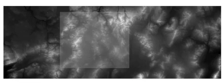
Merge Multiple Rasters in QGIS (Create a Raster Mosaic)

Merge Multiple Rasters in QGIS (Create a Raster Mosaic)

With GIS analysis it’s a common occurrence that multiple raster tiles are required to cover a study area. For many analyses, and specifically hydrological analyses, a seamless, single raster is needed. The solution for combining multiple raster layers is to perform a raster merge, also referred to as a raster mosaic. QGIS uses the the…

|

R: Get data from a NetCDF

List the data attributes Accessing the var property of our netCDF varialbe will list the data attributes for the netCDF file. The output shows us this dataset has one data attribute with the name ‘data’. Which is contained within the names property of var. Calling the names property directly after the attributes() call gives the same result. We can get the name of specific…