Unsupervised Land Cover Classification with Python
| | |

Unsupervised Land Cover Classification with Python

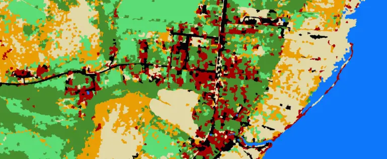
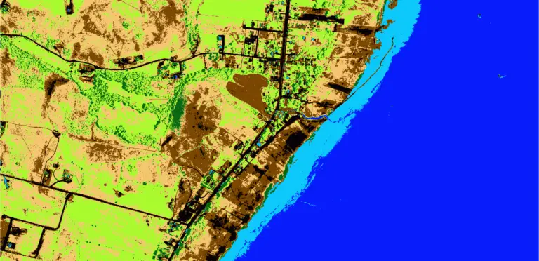
Aerial imagery is used for purposes ranging from military actions to checking out the backyard of a house you might buy. Our human brains can easily identify features in these photographs, but it’s not as simple for computers. Automated analysis of aerial imagery requires classification of each pixel into a land cover type. In other…

Python: Geographic Object-Based Image Analysis (GeOBIA) – Part 2: Image Classification
| | | |

Python: Geographic Object-Based Image Analysis (GeOBIA) – Part 2: Image Classification

Use the random forests algorithm to classify image segments into land cover categories. This post is a continuation of Geographic Object-Based Image Analysis (GeOBIA). Herein, we use data describing land cover types to train and test the accuracy of a random forests classifier. Land cover data were created in the previous post. Step-be-step video instructions…

Python: Geographic Object-Based Image Analysis (GeOBIA) – Part 1: Image Segmentation
| | | |

Python: Geographic Object-Based Image Analysis (GeOBIA) – Part 1: Image Segmentation

This tutorial will walk you through segmenting and classifying high resolution imagery using Python. Part 1 of this tutorial teaches how to segment images with Python. After you have completed Part 1, Part 2 will teach how to use machine learning methods to classify segments into land cover types with Python. YouTube videos give step-by-step…