Geocode Addresses for Free (the EASY way)
Geocoding (i.e. geolocating) is the process of converting street addresses to coordinate pairs that can be easily mapped. Addresses are very useful but are difficult to map without converting them to coordinates first.
There are many softwares that will geocode addresses to coordinates for you. Some are free and some are paid. Each software has different capabilities and requirements for address formatting.
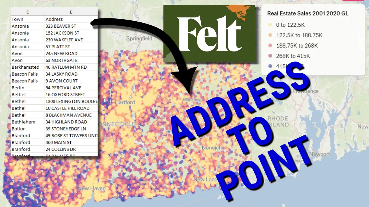
There is one new service, Felt, that uses artificial intelligence to make geocoding easy. Felt uses a large language model (AI) to identify which columns contain spatial information. Based on the information available, it will automatically decide on an open-source geocoding library to use. Then it will geocode your addresses and display them on a map.
All you have to do is drag and drop your file of addresses into Felt.
Let me show you how to do this.
1. Log in to Felt
You’ll need a Felt account for this, but don’t worry, it’s free. Once you have a Felt account, log in. Now, start a new map, or open and existing one where you want the addresses to appear.
2. Prepare your addresses
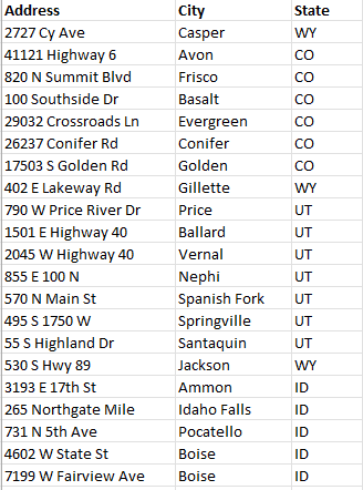
Felt needs a tabular data file (data in columns) to geocode your addresses. The more information you can provide, the better. At a minimum, you’ll want to include the street address, city, and state/province/region. Adding a postal code will help solve any ambiguities, but it’s not totally necessary.
Here’s the data I’ve used for this example. It’s a list of addresses for a repair shop in the United States. I’ve tried to provide the minimum amount of information to see how well Felt’s automation performs.
3. Upload the addresses to Felt
Go over to your Felt map and drag in the file with addresses, click the ‘Upload Anything’ button, or select Felt > File > Upload anything and upload your addresses.
You’ll get a notice asking if you want to upload the file as Elements, foreground features you can edit, or a data layer. You can choose either one. But if you want to export your layer in GeoJSON format to use the geographic coordinates somewhere else it’s best to select ‘Elements’.
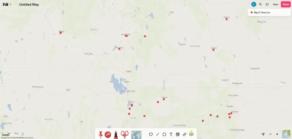
Now, you’ll get a notice that your file is uploading. Then you’ll get a notice that your file is processing. Once your file is done processing, the addresses will automatically appear as points on the map.
You can adjust and edit the point’s symbology and attributes just like any other map feature.
From here, you can share the map publicly or privately, or export the points for display in other mapping or geospatial software.
4. Export the layer
Now that you’re addresses are geolocated, you probably want to save the file externally so you can use it in other software. This is easy to do.
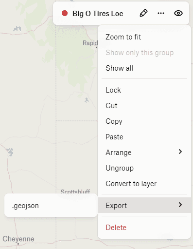
In the Table of Contents/Legend (right side of the screen), click the ellipsis (three dots . . .) next to the layer name. Select Export > .geojson. Specify an output name and click ‘Save’.
Alternatively, you can open the main Felt menu (upper left corner) and select File > Download all elements as GeoJSON.
The GeoJSON will have the X, Y coordinates for each address along with all the attributes in the original file. It can be opened in any GIS software, such as QGIS.
It’s just that easy
That’s all there is to it. Free and easy geocoding.
Felt’s AI makes it super simple to perform this task that was pretty complicated just a few years ago. I may be dating myself, but remember when the easiest way to geocode addresses was to pay for it through ESRI’s products. I’m glad those days are over!