How to Install Mamba for Python
Python is a powerful language with many powerful packages. However, managing Python packages can often…
Interactive Split-Screen Map with Python
leafmap_split Visualizing raster data is important for assessing the results of analysis and models. One…
How to Install GDAL for Any Operating System
GDAL, the Geospatial Data Abstraction Library, was designed to interact with raster and vector (geospatial)…
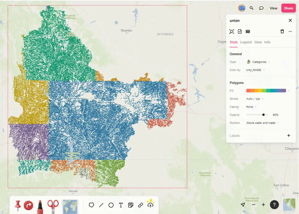
Creating New Shapefiles in QGIS
A shapefile is a file format that represents geographic data in vector format. Shapefiles define…
Make Public Web Maps with QGIS and Felt
Web maps are the best way to share data with an audience. They are also…
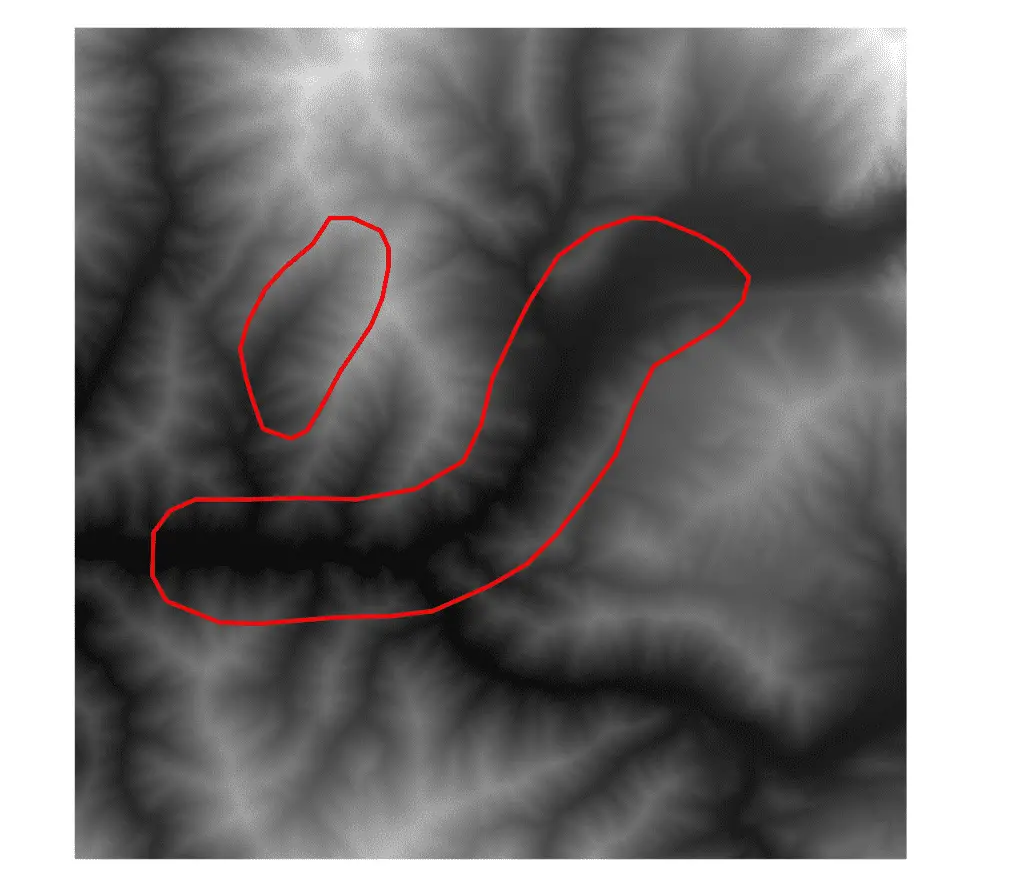
Creating REMs and Detrended DEMS with Python
Relative elevation models (REMs) adjust a DEM so that the elevation is relative to another…
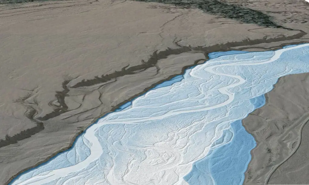
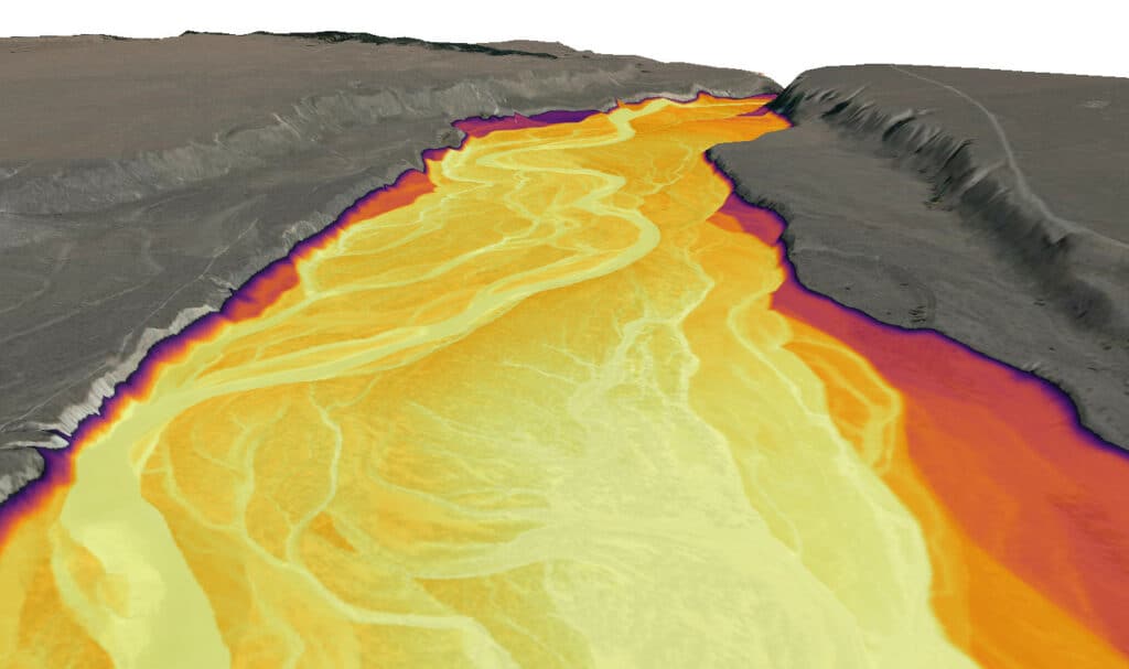
Creating REMs and Detrended DEMs in QGIS
Have you ever seen those really awesome visualizations of rivers that are made with elevation…
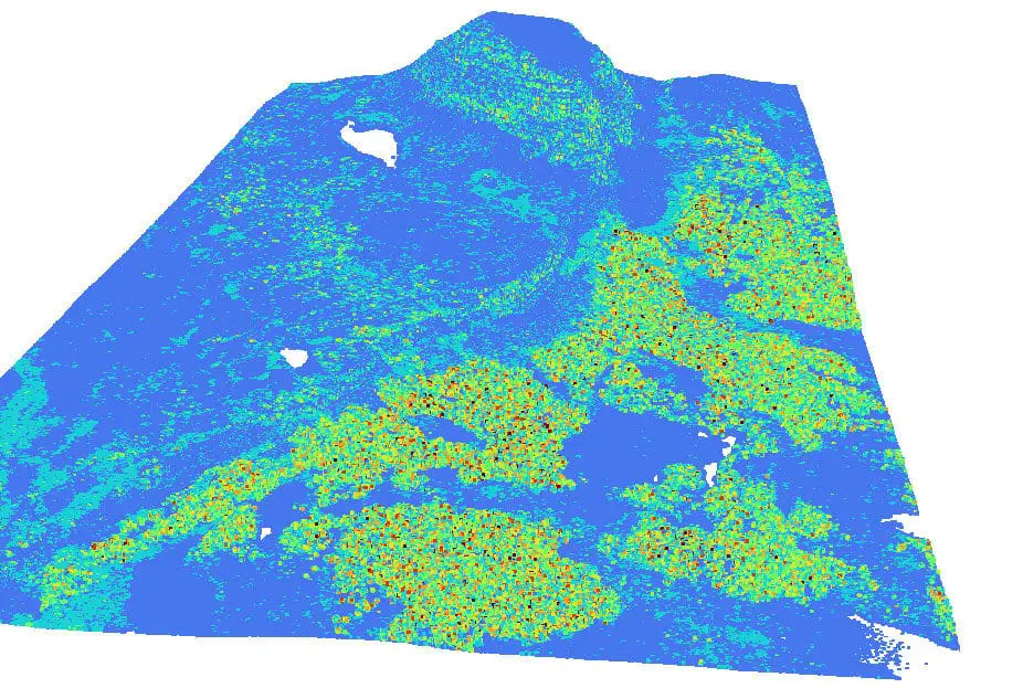
Download and Display Lidar Data for the United States
Lidar data is awesome! It has so many great uses and produces some amazing visualizations….
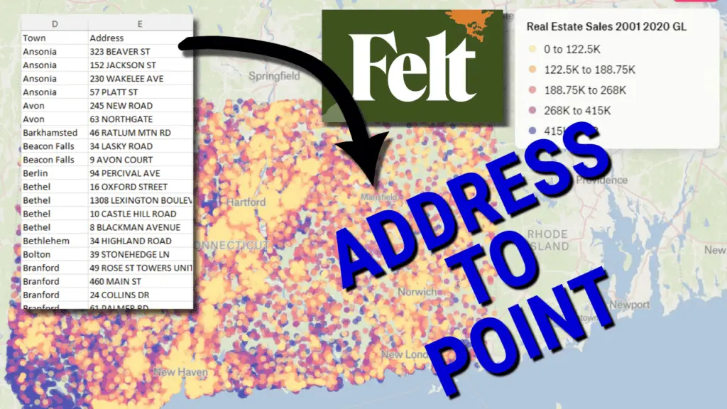
Geocode Addresses for Free (the EASY way)
Geocoding (i.e. geolocating) is the process of converting street addresses to coordinate pairs that can…
The Easiest Way to Install Python on Windows 11 (also works for Mac and Linux)
Having trouble finding an easy way to install Python that always works? You’re in the…

Reproject Raster and Vector Layers with QGIS
Split Screen View and Multiple Map Views in QGIS
In cartography and GIS, it is to display two different products side by side to…
How to Clip a Raster to a Polygon or an Extent with Python (Extract by Mask)
8 Ways to Create (Initialize) Pandas Data Frames
One of the key tasks for data scientists and computer programmers is to read, write,…

4 Ways to Run Python Code in Visual Studio Code

How to Install GeoPandas and Check GeoPandas Version
GeoPandas is a high-level Python package for reading, writing, analyzing, and manipulating vector (points, lines,…
Remote Sensing Analysis with QGIS
In geographic information science (GIS), remote sensing is the act of acquiring information about the…
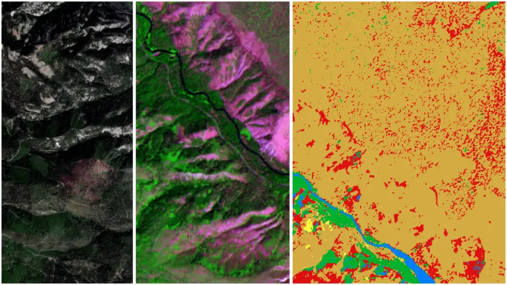
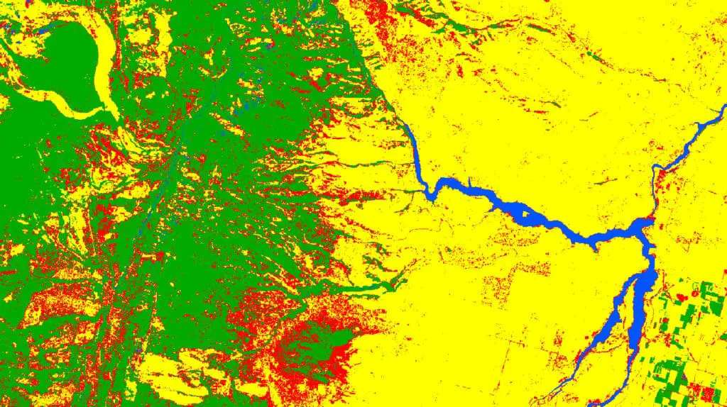
Supervised Image Classification with QGIS
Image classification techniques are at the heart of modern remote sensing. Image classification is a…
QGIS Python Tutorial (PyQGIS Tutorial)
If you’re looking for a way to automate your GIS workflows and products, the QGIS…

Mapbox Tutorial: Create Custom Web Maps for Free
Web maps are a great way to publish and share geospatial data. However, if you’re…
How to Make a Web Map with QGIS using the qgis2web plugin
GIS software makes it possible to create maps that contain a lot of powerful and…
Unsupervised Image Classification with QGIS
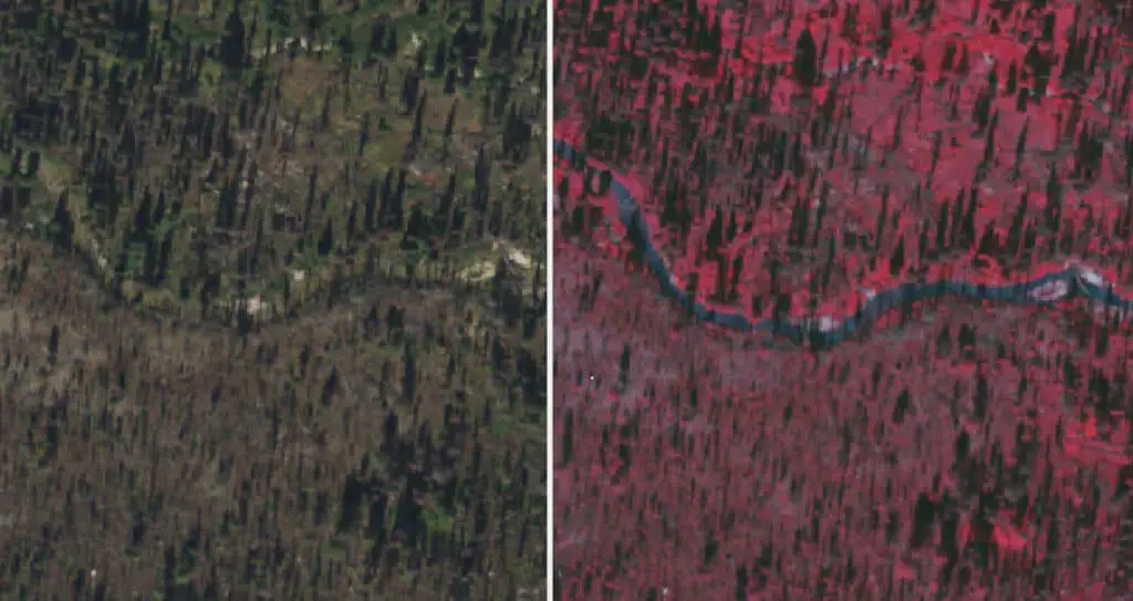
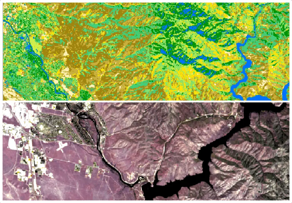
A split image where the bottom half shows the Landsat 9 image in true color…
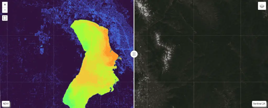
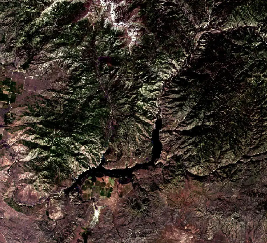
How to Download Landsat and Sentinel Images for Free
Satellite images are important data sources for many remote sensing and GIS analyses. Today many…
GDAL Python Tutorial: Reading and Writing Raster Datasets
The Geospatial Data Abstraction Library (GDAL) is the standard for managing spatial data formats. GDAL…
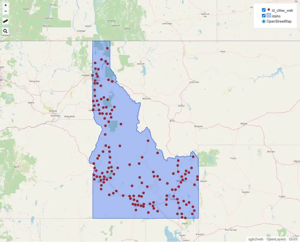
QGIS: Create Points from Excel or CSV
When working with spatial data it is common to have a file that has columns…
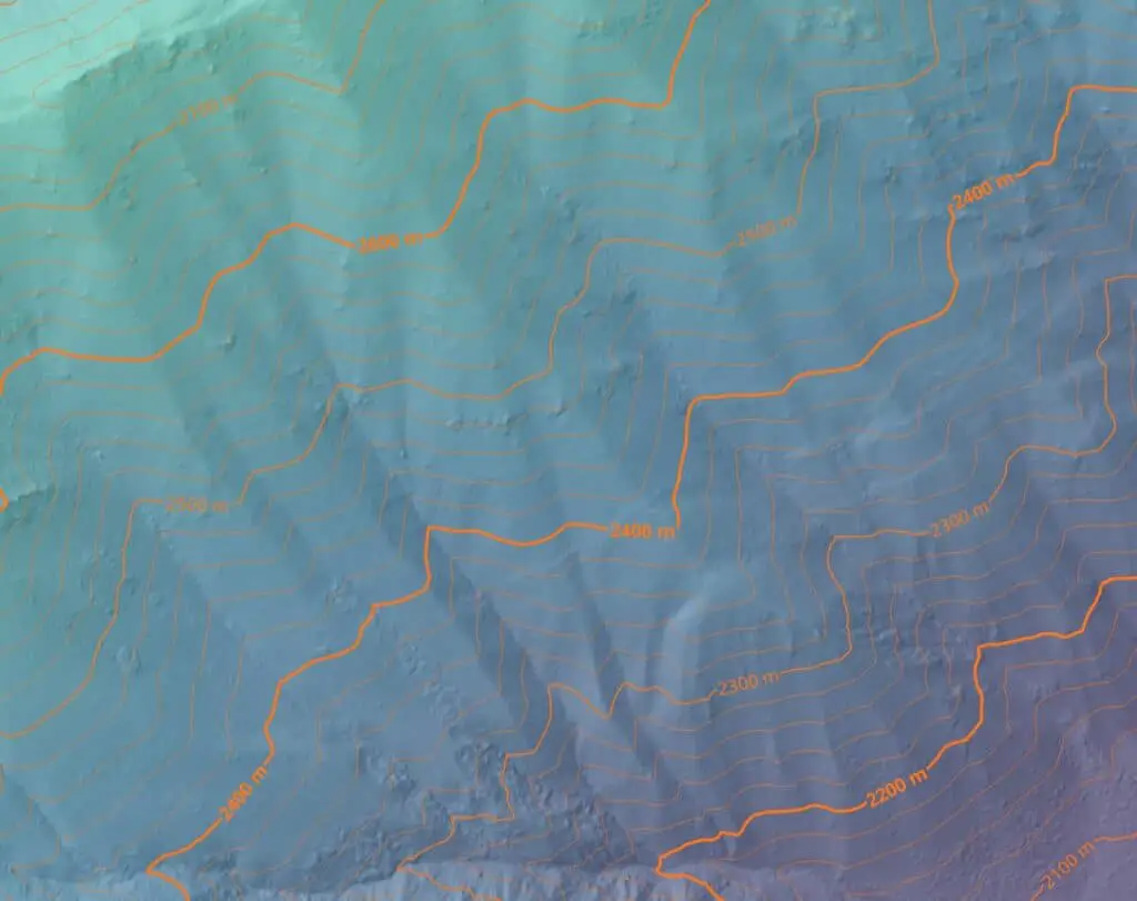
How to Create Contour Lines and Labels with QGIS
Contour lines are most often used to represent topography on two-dimensional maps and figures. However,…
Run Python and Start an Interactive Session from the Windows Command Prompt (Terminal)
Python is a very versatile and popular cross-platform programming language that is used for many…
Use Python to Download Multiple Files (or URLs) in Parallel
Automating file downloads can save a lot of time. There are several ways for automating…
Jupyter Notebooks in Visual Studio Code
Over the past couple of years, Visual Studio Code (VSC) has become my favorite Python…
The Correct Way to Generate Random Numbers in Python with NumPy
Random number generation is a common programming task that is required for many different programs…